[P2] Week 5 – Parallax

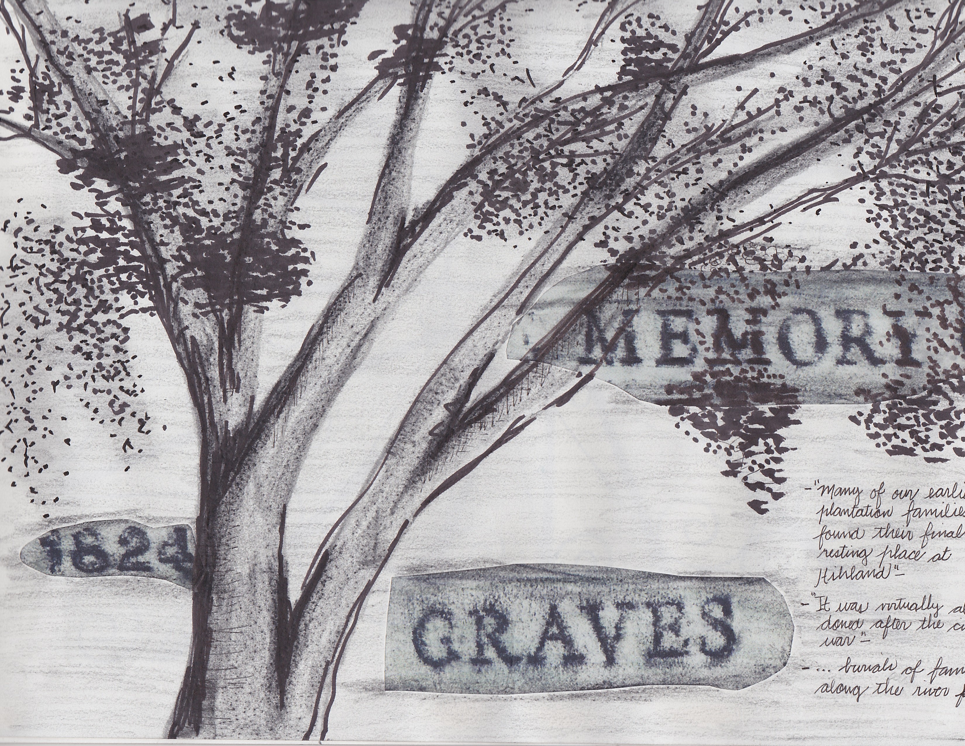
For this assignment I will focus on a small area of the cemetery, located on the northeast side of the site. This area is a small graveyard owned by the Favrot family. There are around 15 above and below ground structures here, most of them burial shafts and graves. I am interested on documenting and analyzing what is above the datum and speculating on what is below. What I see from the position above the datum will formulate questions on what is below it. The topography, the vegetation, and the surrounding structures will inform my decisions to project the past and future conditions of this particular area of the cemetery.

I will combine both a plan view of the area and a section / perspective using architectural projections to document the quality of the space and the existing structures. At the same time, I will explore other ways to represent the processes that occur daily in this area. My intention is to use different media with layered data on it, and to build this drawing with iterations of my findings during the analysis of this part of the cemetery.

Below is a sketch of the idea I have for this drawing.

IMG_5007
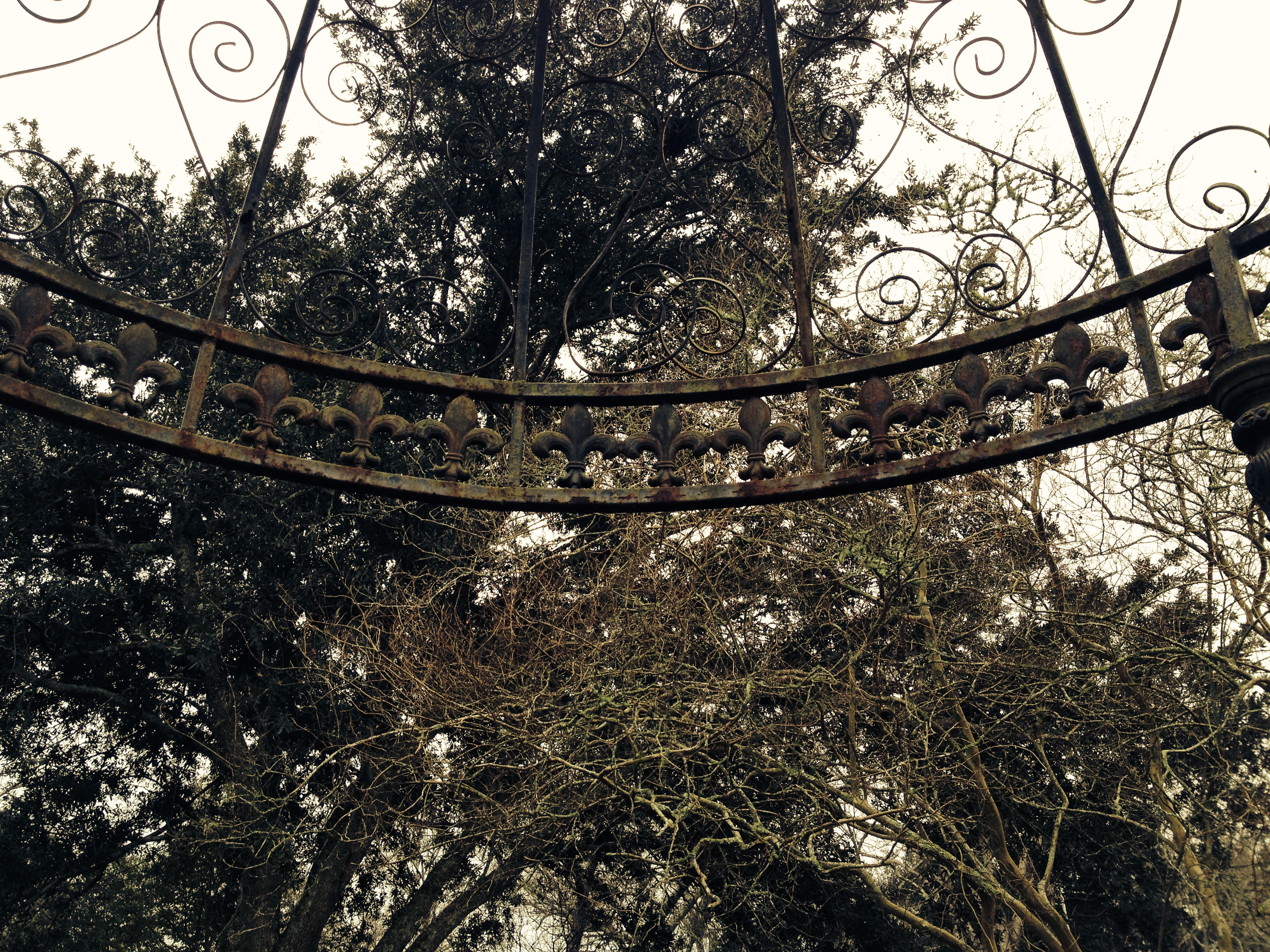
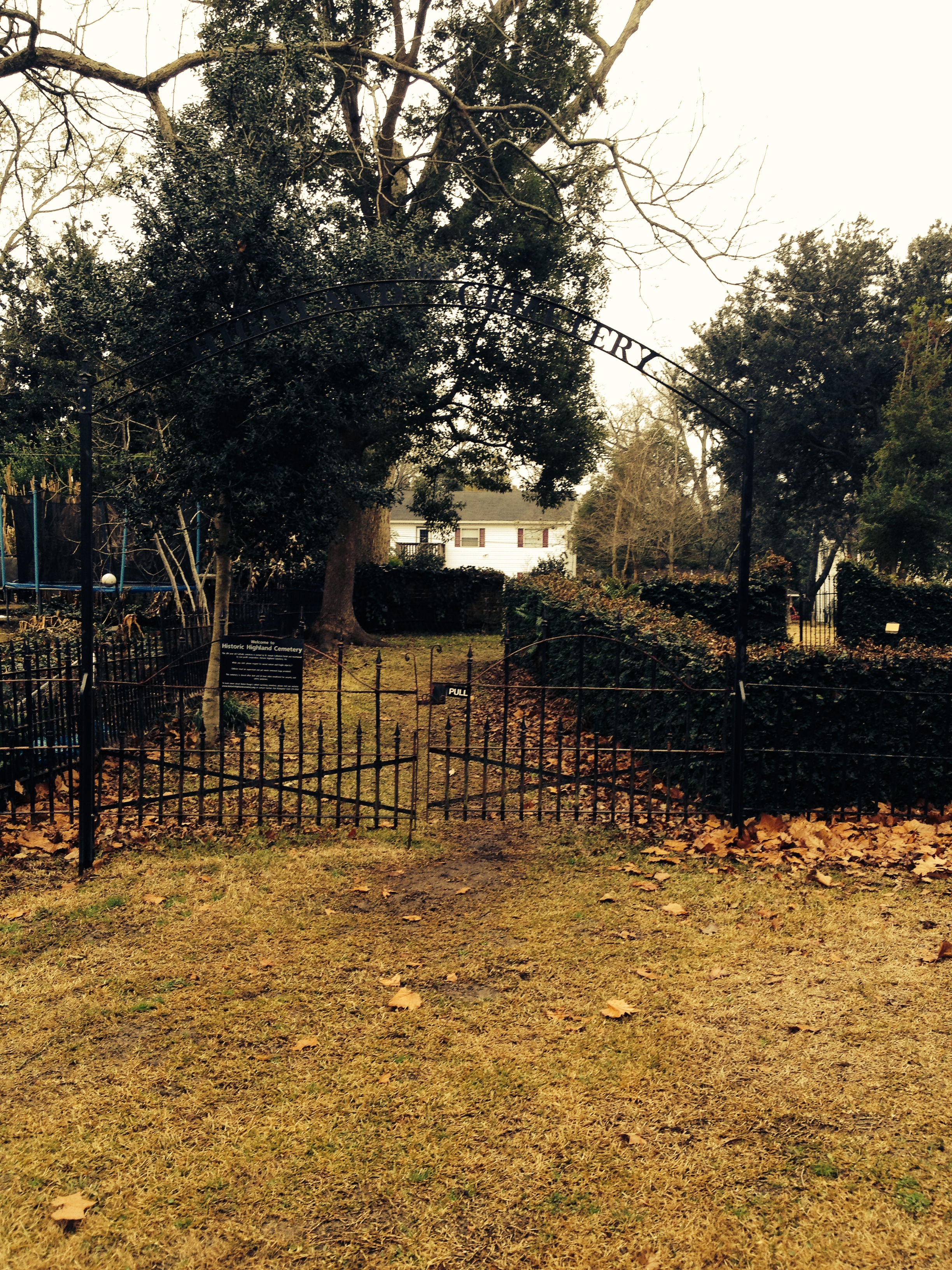
This is what I have started for this drawing, this will serve me as the base image. I will be subtracting and adding information to this photography.

Pano3INVENTION:

The drawings of Frank Drasme are a good source of inspiration for this assignment.  He developed this series of images that explore and narrate in a different way his journey through the city of Amsterdam. This project was called Project 360 degrees. He created a collage-like image taking into account the environment that caused this experience.

frank-dresme-2 frank-dresme

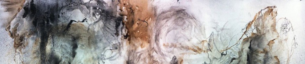
I have also been looking into Richard Wahdcock’s work. His contemporary landscape paintings capture the atmosphere of a place in a very dramatic but subtle way. His abstraction of the landscape creates a different reality through color and tone.

401464_vallery-descent--oil-on-panel t_370666_strand

[P02] Week 04 – The collapse of the represented object

“.. an object that was and is no more.” – Alberto Perez Gomez

I started the next two drawings thinking about this quote from this architectural historian. The two following drawings are trying to express the idea of ​​separating the reality of the things we represent and represent them in a different way. To give them my own interpretation. This made me more aware of the light and its relationship with the different elements on the landscape. I was also looking at solids and voids, notable colors and textures.

This first drawing represents void and masses against the sky. It explores how the silhouette of vegetation contrasts with the sky at the site. I experimented with black and white conté crayons for this drawing.

SCN_0006
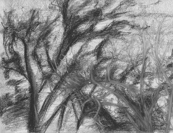
This second drawing represents a view looking out from the cemetery into the residential area adjacent to it. The darkness of the site is now contrasting with the different colors of the houses across the street. The masses and textures of the vegetation become a translucent vail in which I am able to see beyond the site. I kept experimenting with conté crayons for this drawing.

SCN_0008

[P02] Week 03 – First Drawing Attempts

It has been a while since I have set down in a place, observed it, analyzed it, and hand drawn it. This is my first drawing attempt for this class. After a long week of terrible weather I was finally able to go to the site.  The two drawings posted below represent a rushed visit to the site (it started raining right after I got there). My intention was to represent the things that capture my attention the most while I was there. I couldn’t help looking at the beautiful oak trees  in the middle of the property as well as the sculptural crape myrtles right next to where I was sitting. The site is filled with layers of cultural and ecological history that I envision to represent for this second assignment.

SCN_0004 SCN_0003

– Narrating the Site Story –

For this class I will be documenting the Highland Cemetery, here is a little background of the site:

– The cemetery situates in a residential neighborhood south of the LSU Campus. The site was used as a community burial ground in the early 1,800’s. Currently the site is only half of an acre and it contains more than a hundred different mausoleums and tombs. Among the people interred at this cemetery are Armand Allard Duplantier, French officer who served with Lafayette in the American Revolution. The site serves as a small park to the surrounding community and it connects to an existing children playground in the back of the property. The site holds a range of native trees an plants attracting a great amount of birds and other animals. –

Textures

[ Textures of the Site ]

IMG_4905IMG_4889

[ Back Entrance to the Cemetery ]

LA7002 – Ramble Park

I figured I needed to update my blog. It has been a while since I last posted and wanted to share some of the final work that I did for LA7002.

The Ramble Park at the Desoto Park site.

Image

The concept for this project was to transform the site’s batture into an interesting new built urban park to accommodate social and ecological systems. The project aims to revitalize the Mississippi shoreline, create and increase the acces of Baton Rouge’s citizens and visitors to natural resources, and specifically reconnect them to the river. The park will enhance recreational opportunities and hold public multi-use spaces for the downtown community and other users that want to experience the river batture.
The design was inspired from the idea of river meanders. They create different courses of direction that, if seen as circulation ways, represent an interesting pathway network. At the same time, the overlapping of the meanders create ambiguos areas between them where programmatic spaces or vegetation patches can be determined. The dynamic quality of the meanders was also implemented to create dynamic landscapes to enhance the experience of the park’s users. In this way, the articulation of such meanders directed the topographic elevations of the project to provide a variety of edge conditions.

Image

The following post will show the site plan and views of the park.

0.006 Site_Observation

The following site observation was beneficial to understand the different pedestrian systems that will connect to the future Desoto recreational park. The different vectors show the topographic change that a pedestrian user will experience along the way when approaching the site. At the same time, they show the different urban elements and the transition of enclose and open space that would be perceived. It is clear that in many of the vectors there are elements that will block the free pedestrian locomotion and these will have to be modified for the park’s benefit.

In some points along the vectors, it is evident that the park is not seen at distance. This could be as obvious as being too far away from it and in some cases it was due to the topography of the area or other urban elements that were blocking the view to the park. This creates an opportunity for the design of an infrastructure that could be seen over a long distance or to implement a repetitive element in the vector that could attract the users to the park.

In addition to this, I found that there are facilities around the site that can supplement parts of the project’s program requirements. For example, parking garages and public parking lots were found in serveral vectors; this could easily complement the number of parking lots that the park needs. Also, facilities such as the Capitol Complex Central Plant becomes important because of its proximity to the park. This facility could also be use for the maintenance of the park.

This plan view shows the different circulation systems (vectors) that connect to Desoto Park and the many facilities that could complement the project’s program.

The different vectors are shown below. Most of the vectors are interrupted by the strip of infrastructure conformed by the railroad and River Road. The vector 4F shows that the pedestrian circulation coming from the South to the site is totally interrupted by the lack of a walkway. The topography along this vectors is very inclined towards the river.


0.006 Site_Observation_{choose your own adventure}

For this site observation we are required to come out with our own strategy to gather data for our project. In the next month I will be working on the design of a recreational park at the Desoto park site. I am currently interested in the idea of how the future park users will get to it; the pedestrian circulation ways that they might take and the experiences that they will get along these routes before reaching the project. When analyzing the urban location of  Baton Rouge’s Downtown, it is clear that there are several circulation arteries/systems that converge on River Street, adjacent to the project.

I am particularly interested in six of them:

  • The northern connection to the casino site
  • Capitol Lake Dr.
  • State Capitol Dr.
  • Spanish Town Road (crossing the Visitor Center)
  • North Street
  • The south connection to the pedestrian levee system that connects to LSU

I believe that the conversion points of the these circulation axes can create design opportunities for  “entrances” or nodes for the project. With a good design approach these “nodes” can be articulated properly to create an internal circulation system in the park.

Technique:

-Sections / Elevations showing the spatial sequences and the most characteristic elements of each of the vectors.  Vectors could be 500 ‘-700′ long, scale TBD.

– Plan showing the vectors’ trajectory and identifying public or private facilities that offer services that can supplement the project’s program.

See diagram below for reference:


2.001 System_Illustrate

For this project we were assigned to research and illustrate a system that affects Desoto Park directly or indirectly. I chose to represent the Human Disturbance System and was interested in the way this disturbances changed the morphology and ecosystem of the site from it’s normal condition to what it is now. My intention was to illustrate the development, intensity, frequency and synergy of such disturbances throughout  the years. I used a timeline to show the progression of the human interventions on the site from when the place was in it’s “natural state” to the present. At the same time, this interactions were linked with natural disturbances that could have exacerbated them.

It was very important to recognize that the site is constantly changing, not only by human influences but also by natural systems. Being located next to the Mississippi River, the site is temporarily flooded and receives a flow of sands and silt periodically. This has a direct effect on the flora and fauna that develops in the batture.

1.002 Connect

Below is part of the final project that Prentiss Darden and I presented for studio. The diagrams, site plan, sections and perspective try to represent the concept we used to connect the urban area of downtown Baton Rouge with Desoto Park and the Mississippi River. The final concept that we developed for this project was the ecological and human connection through a hybrid expression based on the typologies found in urban and ecological systems.

The most interesting and repetitive typology that we could find in nature was the branching. This allows the derivation of secondary connections from a single one to  create more opportunities for connectability.

At the same time, we use the idea of how plants grow on the ground and how they connect and traverse the subsurface. This helped us to structure our connection taking into account the similarity of the site, where the project is developed, with this idea. There is the upper urban area (above) and the lower batture (below) and both are divided by a narrow strip of infrastructure (River Road and the railroad). In the same way as a plant does, our connection takes place above the infrastructure strip (datum) and after traversing  it, it disperses below the datum creating new sub-connections on the lower Mississippi batture.

Sections